Complete UAS Package For Sale
$25,000.00
Original Purchase Price: Aprox $45,000
Low Usage
This is a rare chance to secure a top-tier survey drone in excellent condition, delivering dependable performance and exceptional value without the uncertainty of rising costs or limited supply. This package offers a rare opportunity to acquire high-end aerial mapping and LiDAR capability for a DJI M300 with less than 25 total flight hours. The kit includes both the Zenmuse P1 high-resolution camera and the Zenmuse L2 LiDAR sensor, providing the versatility to capture ultra-accurate photogrammetry and detailed 3D terrain data in a single system.
This offer is only sold as a package.
DJI Zenmuse L2 LiDAR You Can Trust in the FieldCapture dense, highly accurate 3D point clouds with ease. The L2 delivers survey-grade LiDAR data even in challenging terrain or vegetation, making it ideal for topographic surveys, corridor mapping, and as-built documentation.
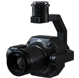
The DJI Zenmuse P1 pairs a 45 MP full-frame sensor with a global mechanical shutter to deliver crisp, distortion-free imagery at centimeter-level accuracy. Designed for professional surveyors, it streamlines aerial mapping—capturing large areas quickly while maintaining precision for orthomosaics, topographic maps, and 3D models.


After Sale Training
If you are located in Oregon and within 100 miles of Portland, at no additional charge, I will provide training on equipment set up, mission planning, image capture and processing of the data. I will travel to anywhere in the US for an minimal additional fee to cover travel and lodging.
503-449-4804
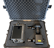
What Does the Package Include
-
DJI Matrice 300 RTK (less than 25 hours of flight use)
-
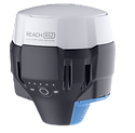
Emlid RS2 Receiver w/carbon pole
-
2 Sets TB60 batteries 1Set TB65
-
Battery Station Charging Case
-
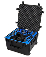
GPC Custom Case for M300
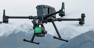
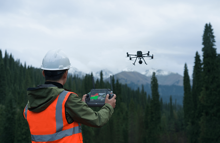
DJI Matrice 300 RTK is a robust and versatile drone platform designed for demanding industrial applications. Its advanced features make it a reliable choice for applications in land development -surveying, construction, conservation, and agriculture.
Benefits
The RTK (Real-Time Kinematic) feature on the DJI Matrice 300 RTK provides centimeter-level positioning accuracy. Extended Flight Time: Offers up to 55 minutes of flight time, allowing for longer missions without frequent battery changes.High Payload Capacity: Supports multiple payload configurations, including the ability to carry up to three sensors simultaneously, enhancing operational flexibility .
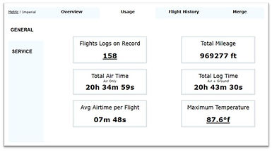
Flight and Equipment Records
Flight data records where kept and are available for review. I used AirData.com which has been valuable to keep a historical account of flights records, equipment condition and maintenance. Full records are available upon request.